
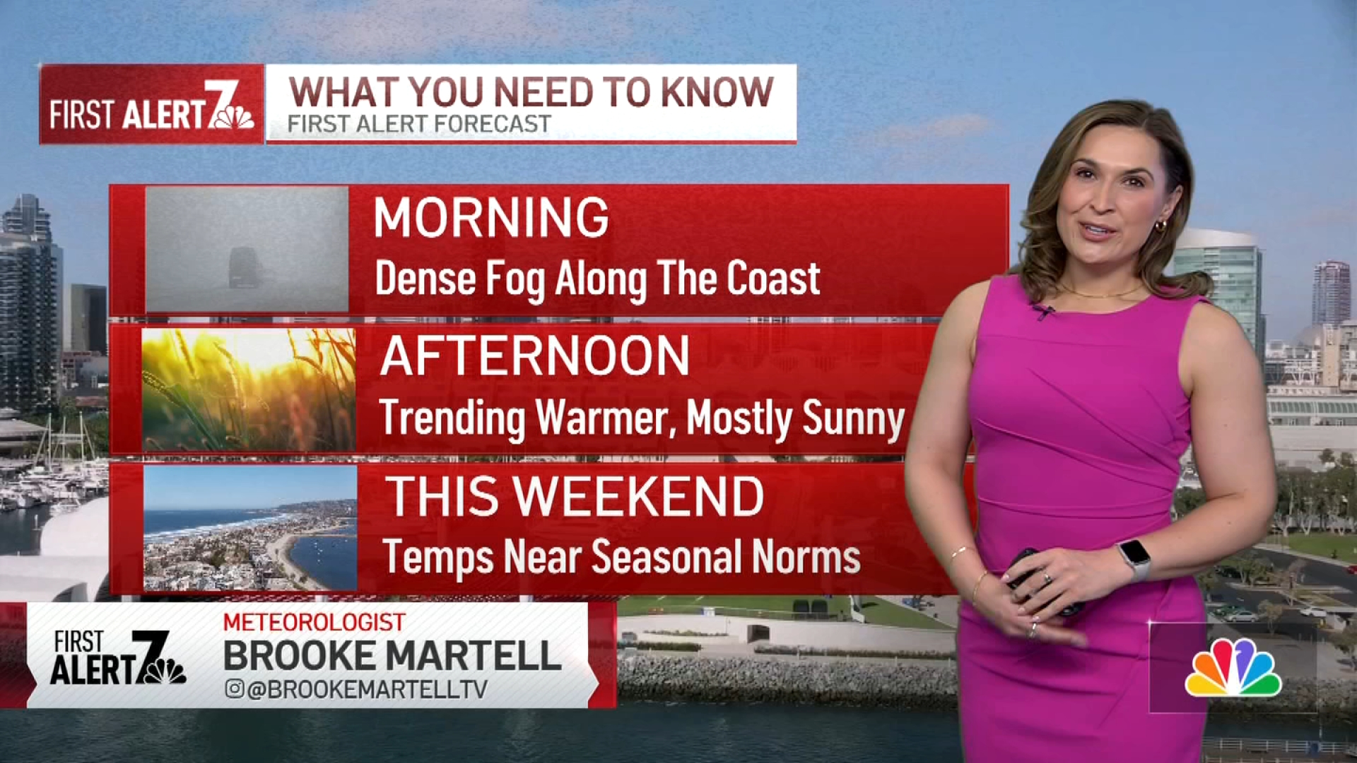
The marine layer is here to stay, bringing areas of dense fog along the coast and inland valleys tonight through the morning, reducing visibility to 1/4 mile and causing patchy mist or drizzle. Drive safely please!

Our latest ridge of high pressure brought record-breaking heat across the region on Friday—Ramona hit 88°F, setting a new record; Alpine tied its record at 87°F; and Campo reached 89°F, breaking its previous record by 2 degrees. That ridge has now moved out, and onshore flow is increasing, bringing cooler temperatures and a return to more typical conditions.
Daytime highs in the inland communities will drop by up to 5 degrees on Sunday, bringing temperatures back to seasonal norms.
Get top local stories in San Diego delivered to you every morning. Sign up for NBC San Diego's News Headlines newsletter.
We also have a full moon this weekend, and it's a micro-moon, which is basically the opposite of a super-moon. Saturday evening's full moon occurs when the moon is at its farthest from earth, therefore it will appear smaller and more faint in the sky. Considering the thick marine layer and fog the best chance to see the full moon tonight will be inland and at higher elevations.

Cooler weather will stick around through the work week, with temperatures gradually dropping each day and becoming much cooler by Friday. We’re also keeping an eye on a few disturbances moving through the area, which will reinforce the cooler air and could bring a slight chance of rain by the end of the week. While the chance is below 20%, any rainfall would be a welcome boost to our yearly totals.

SUNDAY
Weather Stories
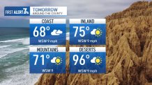
COAST: Morning fog, PM partly sunny - mid to upper 60s
VALLEY: AM Clouds, PM Mostly sunny - mid to upper 70s
MTN: mostly sunny - upper 60s
DESERT: sunny & hot - low 90s