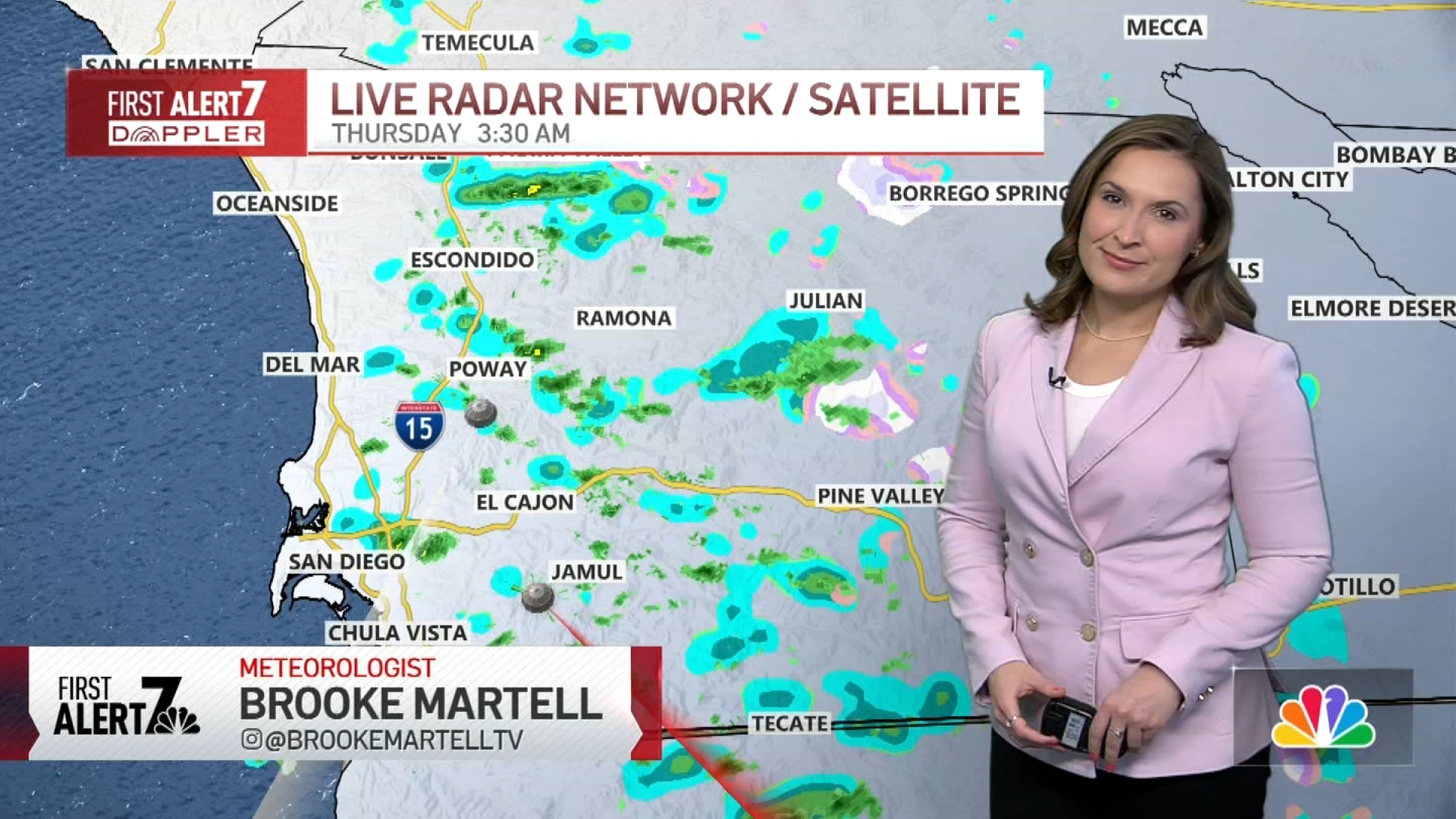
We have received a decent amount of rain within the last 12+ hours.
Here’s a look at some of the rainfall amounts so far:
Oceanside Airport: 0.41''
Leucadia 0.29''
Ramona Airport 0.35''
Julian 0.55''
La Mesa: 0.25''
Chula Vista: 0.19''
SD International: 0.17''
Today will be much cooler too with daytime highs from the 50s west and east of the mountains and in the 30s over our higher elevations.
Morning and afternoon:
Rain chances will increase between 6 and 9 a.m. before tapering off a bit going into the late morning.
We’ll continue to have off-and-on showers for most of the day ahead of the second round of heavier rain going into the evening commute.
Get top local stories in San Diego delivered to you every morning. Sign up for NBC San Diego's News Headlines newsletter.
Thursday evening commute:
Beginning around 3-4 p.m., our rain chances across the county increase, similar to yesterday. Heavier rain is possible for most of the evening, and there are chances of thunderstorms, too. That said, the Excessive Rainfall Outlook that was issued shows a low risk of flash flooding for the county. There will also be more chances for snow across our local mountains. The heaviest part of the system looks to move out before midnight tonight.
Friday morning:
We still have rain chances early Friday and into the morning commute and afternoon. These will be much lighter as the bulk of the storm will have already moved through.
A WINTER WEATHER ADVISORY will be in effect for the mountains from 4 a.m. Thursday through 10 a.m. Friday. The snow level will drop down to around 4,000', meaning areas like Julian and Pine Valley could see light snow, and accumulation of about an inch. Higher peaks up around 6,000' like Mount Laguna and Palomar Mountain may see several inches of snow, possibly 6"+ by Friday morning.

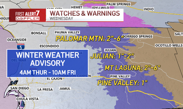
It's also going to be pretty windy on Thursday from the coast to the desert. A WIND ADVISORY will be in place for the desert region through 10 p.m. Thursday, as winds increase from 20-30mph with gusts that could reach 55mph.


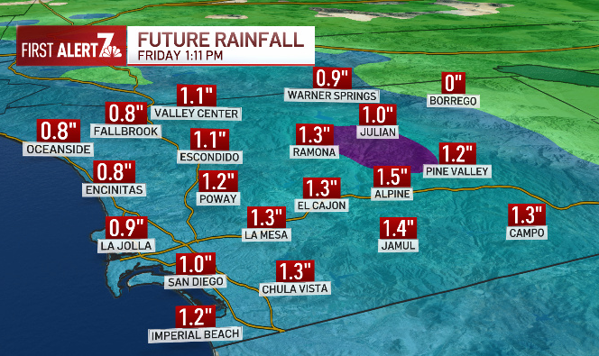
Rain totals spread out over three days will add up to nearly an inch for coastal communities and some inland areas seeing more than that.

As the storm moves out on Friday, the weather will clear, and temperatures will recover warming back to near normal by Sunday. The dry weather pattern will be brief, we could see another round of wet weather next week with multiple chances to help our rain deficit for the year.


THURSDAY:
- COAST: isolated showers, increasing by evening - Highs in the 50s
- VALLEYS: isolated showers, increasing by evening - Highs in the 50s
- MTNS: rain/light snow, more snow by Thursday night - Highs in the 30s
- DESERTS: wind advisory, light showers - upper 50s