
San Diego weather today: Brooke Martell’s forecast for March 14, 2025
Most of the rain from a powerful storm that hit San Diego County on Thursday morning has moved out, but we're not done with wet weather yet.
Another system is bringing rain chances starting mid-to-late morning on Friday and spiking during the afternoon hours, according to NBC 7 meteorologist Greg Bledsoe. That timing means the morning commute is unlikely to be impacted as it was on Thursday, when the California Highway Patrol in San Diego responded to at least 44 crashes.
On-and-off and mostly light showers are expected through mid-to-late afternoon, though a few showers could linger in East County into the evening hours, Bledsoe said. Friday's rainfall could add another quarter to half an inch or more to this week's totals.
Get top local stories in San Diego delivered to you every morning. Sign up for NBC San Diego's News Headlines newsletter.
"In addition to what we got a couple days ago, we could see 2-plus inches some places by the time this week is all said and done," Bledsoe said.
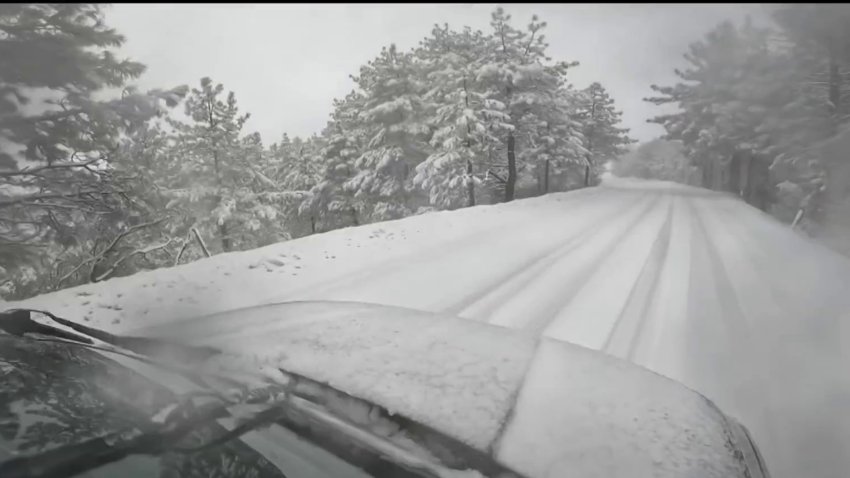
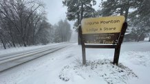
The county's mountains could also see a little more snow on Friday — and the cooler temperatures in the 30s and 40s should keep the snow around for at least the start of the weekend.
Temperatures in other parts of the county will remain cool on Friday, with most areas staying in the low-to-mid 50s.
The rain should be done by Friday evening, leading to a much drier and warmer weekend. Sunday will be the warmest day of the weekend, with temperatures back into the 70s for the inland valleys.
School closures
Schools in the following San Diego County school districts will be closed on Friday due to the weather, according to the San Diego County Office of Education:
- Julian Union School District
- Julian High School District
- Mountain Empire Unified School District
- Spencer Valley School District
Update: Schools in Spencer Valley School District are also closed today due to the weather. https://t.co/aq5o0iYjZV
— San Diego County Office of Education (@SanDiegoCOE) March 14, 2025
Advisories
The county's deserts, including Borrego Springs, are under a wind advisory until 5 a.m. Friday. According to the National Weather Service, west winds could reach 20 to 30 miles per hour with gusts up to 66 miles per hour. Those winds could cause objects and tree limbs to blow around and power outages.
Thursday's storm recap
The second storm of the week, which arrived Thursday morning, delivered quite a punch during the early hours. Not only did several places around the county get more than an inch of rain, but many San Diegans also saw wind, hail, snow in the mountains, a few lightning strikes off the coast and rainbows.
Most of the rain moved out by the evening, but showers were expected to continue to taper overnight. More snow was possible for the mountains.


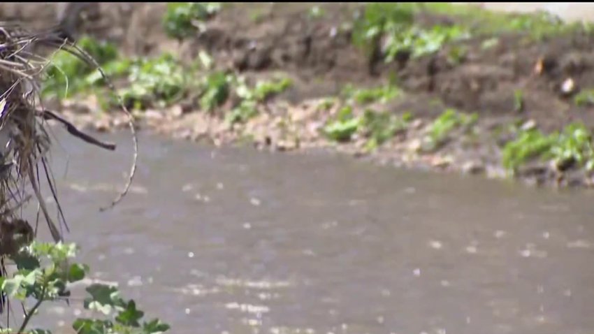
Since one of the biggest concerns on Thursday was flooding, NBC 7 reporters visited areas that have previously flooded during storms.
Last week's heavy rain flooded roadways, prompting rescues in La Jolla and across San Diego. The flooding seen on La Jolla Village Drive did not return on Thursday, but the driving range at the Carlsbad Golf Center flooded once again. Flooding also impacted the eastbound ramp to the state Route 78 from El Camino Real, but the ramp has since reopened.
The San Diego River in Mission Valley reached 9 feet just before noon on Thursday.
Crews were busy on Thursday responding to fallen trees in San Diego. A city spokesman confirmed to NBC 7 that a dozen trees had come down overnight, according to a morning storm report. In Mission Hills, a palm tree fell over around 5 a.m. and caused extensive damage to a home's roof, attic wall and fencing. Nobody was believed to be hurt.

Thursday's rain:
- Santee: 1.52"
- San Marcos: 1.46"
- Ramona: 1.40"
- Escondido: 1.31"
- Imperial Beach: 1.30"
- Oceanside: 1.30"
- San Diego: 0.75"

The first storm touched down overnight Tuesday, delivering a healthy dose of rain that lasted through Wednesday afternoon. Rain totals were approaching an inch in some places.