
Dangerously hot temperatures are in the forecast Friday in parts of San Diego County with an excessive heat watch in effect in the desert communities.
The National Weather Service issued an excessive heat watch from Saturday morning through Tuesday evening in Banning and the San Gorgonio Pass where high temperatures are expected between 110 and 115 and lows between 87 and 90.
An excessive heat watch for San Diego County deserts will be from 10 a.m. Saturday until 11 p.m. Monday. The heat watch is also in effect for the Coachella Valley and San Gorgonio Pass near Banning.
Breezy conditions are in the forecast in the valleys where highs are expected between 87 and 92 Friday.
Get top local stories in San Diego delivered to you every morning. Sign up for NBC San Diego's News Headlines newsletter.
The NWS recommends drinking plenty of fluids, staying in an air-conditioned room, staying out of the sun, and checking up on relatives and neighbors.
Hot Weather in San Diego


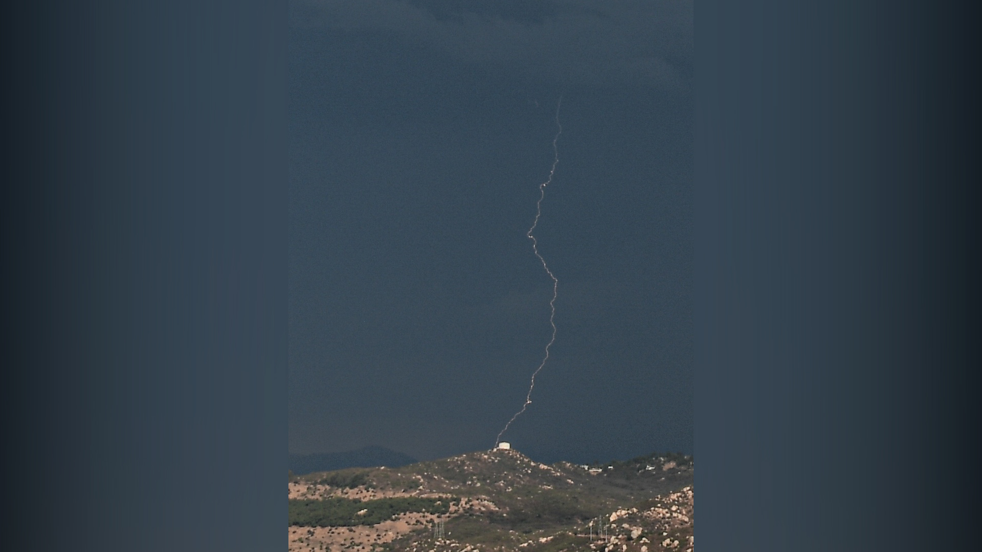
Thursday brought thunderstorms and flash flood warnings for East County.
There were 1,350 lightning strikes, with 142 of those being cloud to ground, according to NBC 7 meteorologist Greg Bledsoe. One ground strike lightning was photographed in Santee by viewer Randy Siegel.
There is a chance of thunderstorms for Friday afternoon mainly for the mountains into the high desert with strong gusty winds, lightning and brief heavy rainfall, the NWS said.
It will be drier from Saturday through Monday with less than a 15% chance of thunderstorms for the mountains each afternoon along with very hot days and very warm nights for inland areas.
Friday temperatures:
- Coast: mostly to partly cloudy, chance shower - upper 70s
- Valleys: mostly to partly cloudy, chance shower - low to mid 90s
- Mountains: PM Chance T-storm - 90s
- Desert: PM Chance T-Storm - 105-110